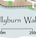
More Information ↓  
 
 
  Printer Friendly Map | Walking Directions  


Distance: 5.5 km
Time to complete: 1 hour

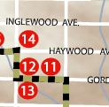
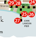
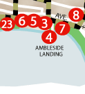
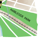
The Hollyburn area has an important historical significance to West Vancouver. The area is associated with one of West Vancouver’s pioneer families: the Lawsons. John Lawson and his family moved to the area in 1907 and immediately began developing their new property. Along the creek bed, or burn as it was known to the Lawsons, many holly bushes were planted. These were John Lawson’s favourite plants and his property became known as Hollyburn. Over time the area grew and developed, incorporating a ferry service from Vancouver, a school, a post office and general stores. Currently, the area is bustling with various retail shops, services and a community park. Many of the original bushes planted by John Lawson still thrive along the east side of the park area.

 
1.  Hollyburn
2.  Ambleside Village
3.  Heritage Square
4.  Ambleside Landing
5.  Ferry Building
6.  West Vancouver Municipal Ferry Service (Lost Site)
7.  Granite Assemblage
8.  Hollyburn Sailing Club
9.  Horse Chestnut Trees
10.  Hollyburn Elementary School
11.  Vinson House
12.  Smith House
13.  Partington House
14.  McMahon House
15.  Clegg House
16.  West Vancouver Secondary School
17.  Keenleyside House
18.  Hay Park
19.  Inglewood High School (Lost Site)
20.  Municipal Hall
21.  Gertrude Lawson House
22.  Fire Hall No. 1
23.  Harmony Arts Festival
24.  Silk Purse
25.  John Lawson Park
26.  Fraser McNair Lumber Company
27.  Lions Gate Bridge
28.  Navvy Jack Thomas House
29.  Thompson House (Lost Site)
30.  Little Wall Street
31.  Eye of Mountain Bear
32.  Hollyburn Post Office (Lost Site)